I bought a drone recently and thought I’d post some shots. I’ll add more as time goes on.
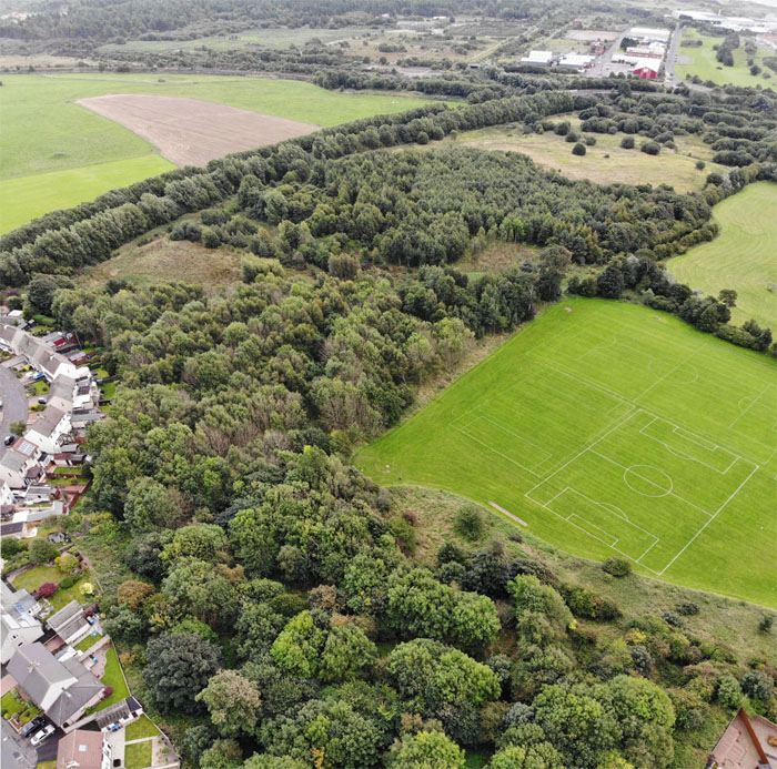
Ardeer Quarry Local Nature Reserve, with the former nylon plant site behind and Highfield Drive/Kilwinning Road to the left.
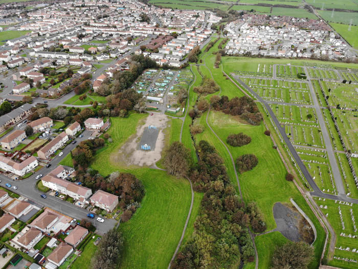
The top end of Stevenston from Ardeer Rec, with the overgrown walled garden of Ardeer House in the foreground, and the solar farm just discernible near the top right of the frame.
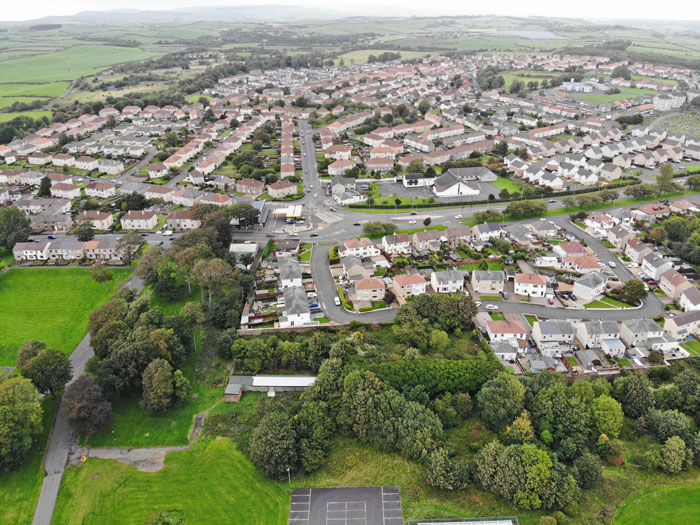
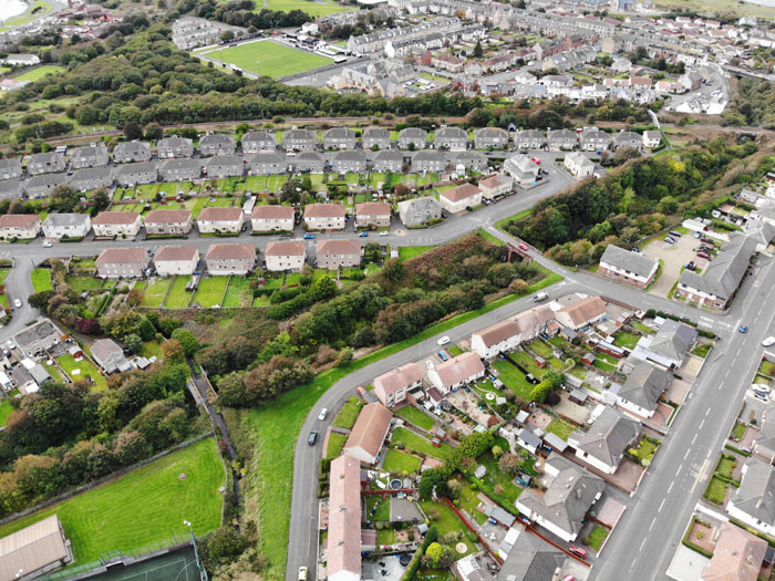
Looking over Hillcrest Drive to the town centre.
A pinewood on the Ardeer Peninsula
The mudflats and saltmarsh on the Ardeer Peninsula. The saltmarsh is the green area in the foreground covered in brackish pools. This estuary contains the largest saltmarsh in Ayrshire.
Iain
Re: Three Towns drone images
Posted: Sun Sep 16, 2018 10:31 pm
by Big Sanny
Absolutely superb photos! Thanks for posting.Really look forward to seeing more in the future!
Re: Three Towns drone images
Posted: Mon Sep 17, 2018 12:19 am
by Hughie
Well done Iain! much appreciated, it adds a new dimension as to what many of us expats remember. I can pick the spot where the Rec building stood at the bottom of the brae.
Re: Three Towns drone images
Posted: Fri Sep 21, 2018 5:16 pm
by iain
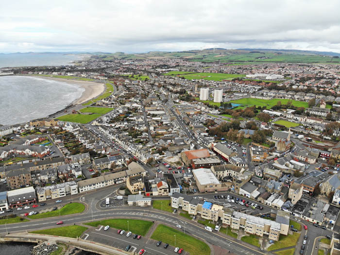
Stevenston town centre.
Looking across New Street, over Livingstone Church, to the Rec and Ardeer Quarry.
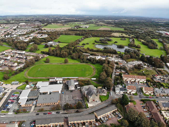
Looking over Hillside Street to Auchenharvie.
The Ardeer Peninsula from Irvine Beach Park.
Looking towards Bogside Flats.
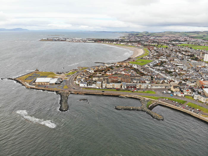
The mouth of the estuary at the southern tip of the peninsula.
Re: Three Towns drone images
Posted: Fri Sep 21, 2018 6:43 pm
by bonzo
More great pics Iain. In the dugtrack one I can see both my dad's and my sister's houses
Re: Three Towns drone images
Posted: Fri Sep 21, 2018 11:34 pm
by Hughie
Very nice, Iain, I can see my great grandparents' headstone in that first image - Hugh McCallum & Mary Kelly. It was a red letter day when I found it a few years back.
Re: Three Towns drone images
Posted: Sat Sep 22, 2018 11:14 am
by michaelm
Agree with other folk's .. Great looking aerial pics Iain!
Re: Three Towns drone images
Posted: Sat Sep 22, 2018 4:47 pm
by exile
WHy is the bridge in the estuary now missing a centre?
Re: Three Towns drone images
Posted: Sat Sep 22, 2018 4:56 pm
by bonzo
It is a retractable bridge to let boats in and out of the harbour.
Re: Three Towns drone images
Posted: Tue Sep 25, 2018 5:48 pm
by iain
A short video of a flight over the sand dunes at Stevenston Beach Local Nature Reserve yesterday.
Re: Three Towns drone images
Posted: Tue Sep 25, 2018 7:36 pm
by michaelm
Great footage of the Beach and 'Sandy Hills' with a good view of Stevenston Burn at the start of the video as well.
Also noticed part of Sandylands Caravan Park at the extreme top right.
Re: Three Towns drone images
Posted: Sat Sep 29, 2018 8:16 am
by iain
Some drone shots from Ardrossan and Saltcoats.
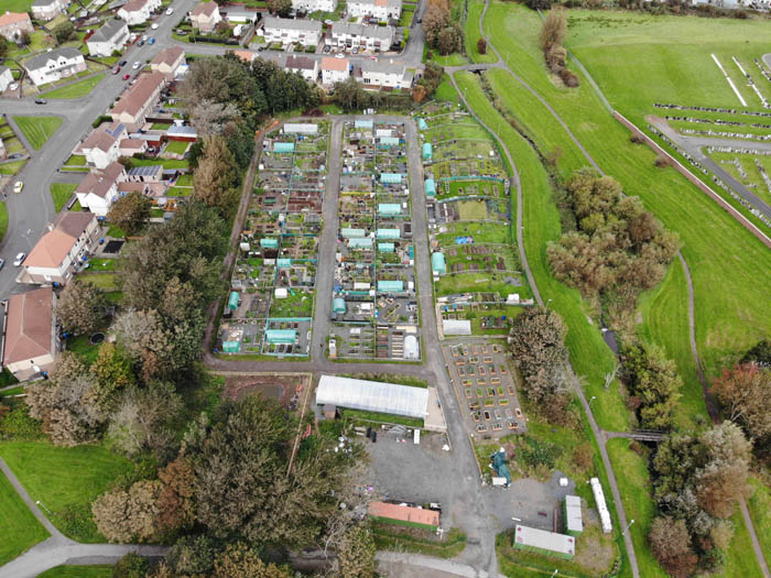
The Three Towns Growers allotments in Elm Park.
Elm Park.
Looking over South Beach Road from the Plantation.
Looking from Elm Park over to Arran.
Looking along Saltcoats’ High Road.
The disused railway line running through Ardrossan – identifiable as a strip of woodland!